
Friday
Feb212014
November 16, 1854 - First Street Map of San Bernardino
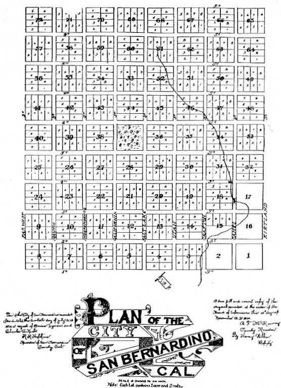
In 1853, Henry G. Sherwood laid out a plan for the City of San Bernardino, much like a miniature Salt Lake City.
It was approved by the Supervisors on November 16, 1854.
The town was one mile square, in blocks containing 8 acres, with wide streets running at right angles.
The north-south streets were given Mormon names which continued for years, then were changed to "letters".
The east-west streets were numbered and their numbers remain the same today as they were in 1853 with the exception of 1st Street which is now called Rialto Avenue.
A block-square public park (later called Pioneer Park) was established in the center of the town.
Town Creek and Warm Creek zigzag through the eastern half of town.
 Share Article