
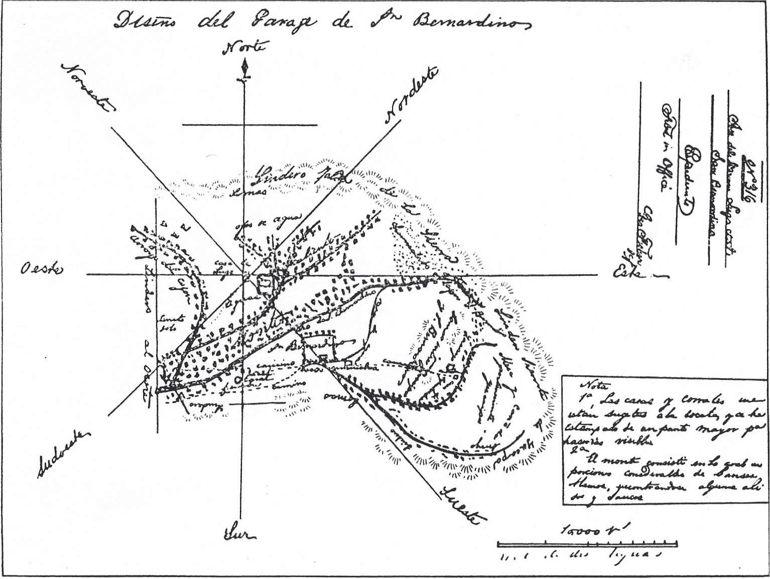
June 21, 1842 - Lugo Map of Rancho San Bernardino
Rancho San Bernardino was created by Mission San Gabriel in 1819. In 1821, Spain relinquished control of Mexico, including Alta and Baja California. All of the Calfornia missions were "secularized" (confiscated) beginning in 1834 and Mexico began approving grants of mission lands to political favorites.
Don Antonio Maria Lugo, was a wealthy land owner in the Los Angeles area when he requested a land grant, covering 35,509 acres in the San Bernardino and Yucaipa valleys, for his three sons and a nephew. It was immediately granted by Governor Juan Bautista Alvarado, his grandnephew.
On June 21, 1842, Governor Alvarado granted the Lugos permanent possession of the land, meaning that they could live on the land and deny anyone but the original Indians the right to remain on the the land.
The three Lugo boys and a cousin were to start colonizing this land by building homes and transferring livestock to the area. Some Spanish terms indicated on the map include:
Saca de agua is the Mill Creek Zanja
Ojos de agua is Arrowhead Springs.
Casa de Lugo, the Lugo house is shown at the intersection of the compass lines [on what is now the 1926 courthouse grounds].
Jacal Jumuba, for former keepers of mission cattle. José María Lugo built an adobe home near the springs at Jumuba [West of Hunts Lane and South of Redlands Blvd.].
Casa arruinadas, mission rancho headquarters and the Assistencia [Estancia], became the home of José del Carmen Lugo [Barton Road and Nevada Street in Redlands].
Casa de Sepulveda in Yucaipa, home of the Lugos' cousin, Diego Sepulveda.
Vicente Lugo built an adobe near De Sienna Springs and Bunker Hill [near Inland Center Drive and I Street].
The Lugos did not succeed in colonoizing the area and eventually sold Rancho San Bernardino to the Mormon Church in 1851 for $77,500.
 Share Article